2013 MARCH / Vol. 5 / No. 3 /
GA
23
requests from companies to urgently
extract key foreign staff based in
remote locations within Africa, which
led us to launch this service with
MS Risk. An evacuation exercise
requires thorough planning well in
advance to integrate the air service
with other logistics involved, and this
is beyond the scope of most other air
service providers," says Chris Frost,
Business Development Manager
for Flight Operations at ExecuJet.
"Often companies have a plan
in place to handle a crisis, but in
our experience most are out of
date before they are implemented.
Together with ExecuJet, we will
work with companies to ensure their
policies are up-to-date and robust
enough to deal with any emergency
situation," explains Simon Barry,
Senior Consultant at MS Risk.
ExecuJet will be also be
showcasing a range of other aviation
services to the mining and resource
exploration sector at stand 1919
during Mining Indaba 2013, including
aircraft and helicopter charter
flights, scheduled services to remote
locations and air cargo operations. ·
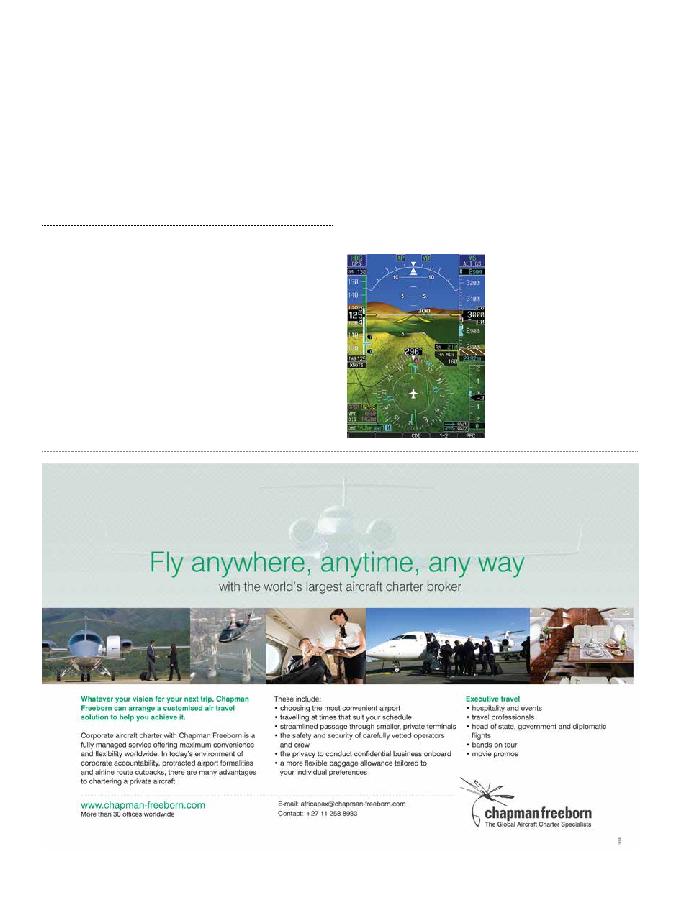
Garmin International Inc., a unit
of Garmin Ltd, has just announced
the GRA 5500, a high performance,
all-digital radar altimeter for
transport category, helicopter,
business and general aviation
aircraft. Using patent-pending
digital signal processing technology,
the GRA 5500 works to provide
smooth altitude tracking resulting
in a consistent and highly accurate
altitude above ground indication,
even over the most challenging
environments like rough terrain, tree
canopies, sand and choppy water.
The GRA 5500 now meets the
highest altitude accuracy standards
only previously seen in products
for transport and military aircraft,
providing pilots unprecedented
confidence in their actual altitude.
Because of its all-digital design,
the GRA 5500 is able to intelligently
process hundreds of altitude
measurements per second and apply
advanced digital filters to help detect
and mitigate false altitude returns.
In addition, the robust and rugged
hardware is designed to withstand
even the harshest environmental
conditions, meeting the latest,
more rigorous flight test standards
recently issued by the Federal
Aviation Administration (FAA).
Patent-pending technology in
the GRA 5500 incorporates built-in
self-test monitors that continuously
cross check the data and system
integrity, assuring the pilot of an
accurate measurement of the height
above ground. This technology
also provides for a simpler
installation, with easy calibration,
and eliminates the requirement for
long lengths of antenna cables that
Garmin® Delivers High-Performance,
All-Digital Radar Altimeter
are traditionally required in the
installation of radar altimeters.
An industry-standard ARINC
429 interface allows the GRA
5500 to integrate with a breadth
of Garmin integrated flight decks
and flight displays, as well as
third-party products. Compatible
Garmin displays include the
G1000®, G1000H, G2000, G3000,
G5000, G5000H, G600, G500 and
G500H. It can also integrate with
existing systems to enhance NVIS
operations and fulfill the radar
altimeter requirements for Class A
TAWS, CAT II ILS operations and
TCAS II/ACAS II. The GRA 5500
is also compatible with Garmin's
new TCAS II/ACAS II solution. A
number of aircraft manufacturers
have already selected the GRA
5500 as standard equipment on new
aircraft including the Cessna Citation
X, Citation Sovereign, Citation
Latitude, Citation Longitude and
the Bell Helicopter 525 Relentless.
The GRA 5500 has received
the FAA's Technical Standard
Order (TSO) authorization and is
available immediately for $13,9951
(antennae sold separately).
For more information, visit
garmin.com